Australia · AUPER
Perth
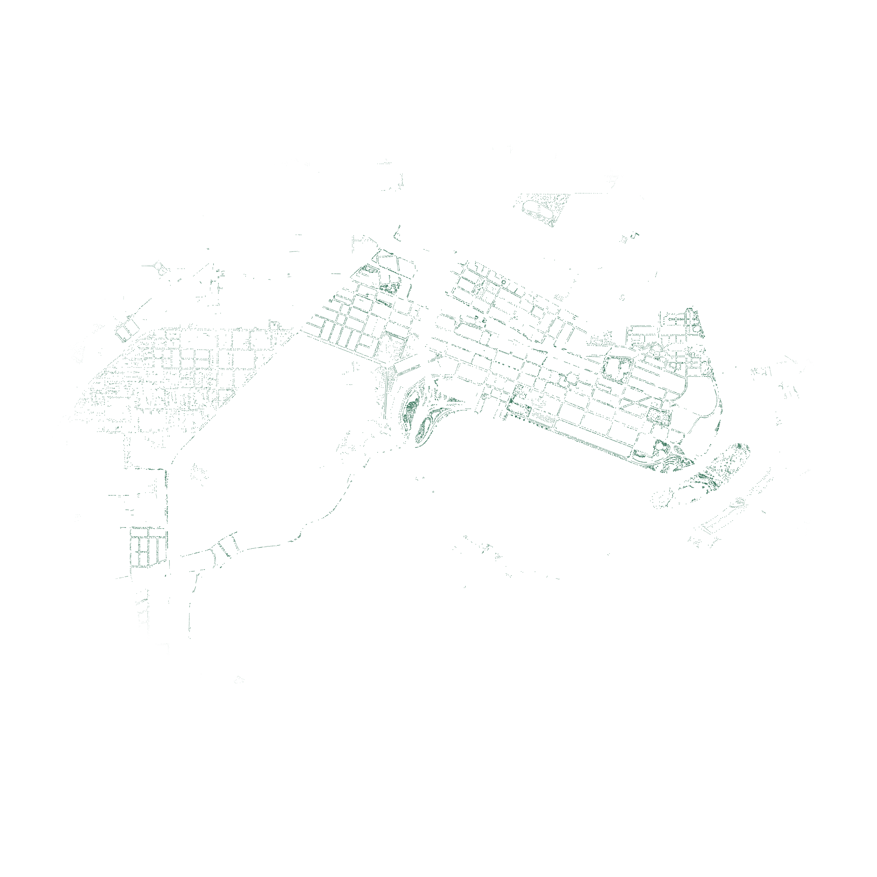
Southwest Australia woodlandsThe urban forest, as recorded in Perth’s published tree inventory.
Inventory totals as of 2026-11-21. Counts include aerial predictions where available and do not describe every tree in the city.

Details
Each dot marks a published tree coordinate. Inventory and reviewed records appear in deep green. Marks can overlap, and inventories can miss trees. Measuring canopy cover requires the area covered by tree crowns. The trees and water fade together near the edge. The count includes every record within the rectangular crop. View the crop, sources and rendering notes ↗
Water boundaries: Overture Maps water / OpenStreetMap. © OpenStreetMap contributors (ODbL-1.0).
Inside the inventory
Of the 24,241 records in the 2026-11-21 profile, 17,287 (71.3%) carry a scientific name. The inventory contains 269 distinct names, including genus-only identifications.
- Most recorded genus
- Eucalyptus · 2,672 records
- Most recorded family
- Myrtaceae · 8,296 records
Ecological setting
The city’s map pin falls within the Southwest Australia woodlands ecoregion, an area with a characteristic mix of species and habitats. Its biome, Mediterranean Forests, Woodlands & Scrub, groups places with similar climate and vegetation. The australasia realm is a much larger geographic region whose plants and animals share an evolutionary history. One realm can contain many biomes.
Planting history
Recorded planting dates grouped by decade.
Available for 5,325 of 24,241 records (22%).
- 1980s2
- 1990s2
- 2000s1,100
- 2010s1,436
- 2020s2,785
Native range
The first group counts trees whose species is native to the city’s ecoregion. Trees native elsewhere are grouped by biome and realm.
Available for 13,554 of 24,241 records (55.9%).
- Local ecoregion4,858
- Same biome elsewhere1,291
- Same realm, different biome4,220
- Other realms and biomes3,185
Leading species
The most numerous species in the catalogue for this city. Unnamed records and genus-only entries are excluded.
- Platanus x hispanicaLondon plane tree2,039records
- Corymbia maculataSpotted gum1,148records
- Jacaranda mimosifoliaJacaranda1,050records
Species summary as of 2026-11-21.
Downloads & sources
Download the published Parquet files for this city. Source licences apply; see the licensing guide and dataset schemas and query examples.
Contributing sources
- City of Perth (Trees in the City)17,121 records · CC BY 4.0
- OpenStreetMap contributors7,120 records · ODbL
Latest contributing source update: 2026-11-20.
Download metadata and source breakdown captured 2026-11-21. These may differ from the latest inventory totals above.