Theurbanforestaround us.
Discover the trees that grace our cities. Open data rooted in the natural world.
- English oakQuercus robur
66,209 trees recorded - London plane treePlatanus x hispanica
58,473 trees recorded - Norway mapleAcer platanoides
52,501 trees recorded
of the forest around us.
MANY CITIES. ONE DATASET.
The urban forest
made visible.
A sophora in Paris. A Japanese pagoda tree in New York. An enju (エンジュ) in Tokyo. Three names for the same species: Styphnolobium japonicum.
City inventories use different names, formats, and measurements. We standardize those records in one open dataset, connecting each tree to its species, location, and ecological information. See the source records ↗
Get to know the arboraryExplore by city.

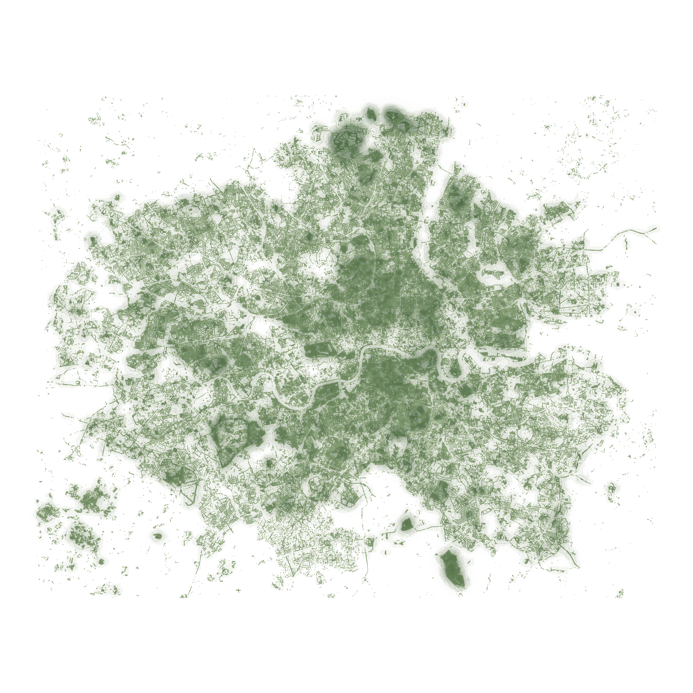
London
United Kingdom · 1,266,241 records in the inventory
English Lowlands beech forestsDetails
These are cropped, north-up maps of recorded trees, shown at different scales. Each mark uses a published coordinate; marks may overlap. Darker tree marks indicate a higher density of records nearby, normalized separately for each city. The wash and contour strokes follow that density. This is not canopy cover, and inventories do not include every tree.
Tree coordinates come from the arborary inventory, which combines municipal, OpenStreetMap and community records. The crop count may be smaller than the full city inventory. View the crop, source and rendering notes ↗
Water boundaries: Overture Maps water / OpenStreetMap. © OpenStreetMap contributors (ODbL-1.0).
Missing your city? Request it on GitHub . A link to the published inventory is all it takes to start.
Collection updated October 8, 2026.
02 / FAMILIAR LEAVES, NEW STORIES
Meet the neighbours.
A few of the most-planted trees in our shared urban forest.
Green ash
Fraxinus pennsylvanica485,285 trees in the atlas
Norway maple
Acer platanoides481,161 trees in the atlas
London plane tree
Platanus x hispanica313,863 trees in the atlas
The ten most-planted species
| Species | Common name | Trees |
|---|---|---|
| Fraxinus pennsylvanica | Green ash | 485,285 |
| Acer platanoides | Norway maple | 481,161 |
| Platanus x hispanica | London plane tree | 313,863 |
| Gleditsia triacanthos | Honey locust | 289,006 |
| Ulmus americana | American elm | 284,694 |
| Tilia cordata | Small-leaved linden | 254,345 |
| Picea pungens | Blue spruce | 222,813 |
| Acer saccharinum | Silver maple | 140,729 |
| Quercus robur | English oak | 133,490 |
| Malus | Apple | 123,263 |
Botanical sketches are illustrative. Explore each species for photographs and details.
A RESOURCE TO MAKE YOUR OWN
Good things grow
from open knowledge.
Follow your curiosity through the map, or bring the data into your own work. Every city, one shared schema, no signup.
Built from municipal open-data inventories, OpenStreetMap, and community contributions. Every record keeps its source. Inspired by the work of OpenTrees and Falling Fruit. The pipeline and the map are open source at greenmtnboy/tree_reporting; new cities are added on request.
Earth is home to an estimated 3.04 trillion trees. We’ve mapped 0.00039% of them. There’s a whole world left to discover.