Skip to content
Image gallery
Boston
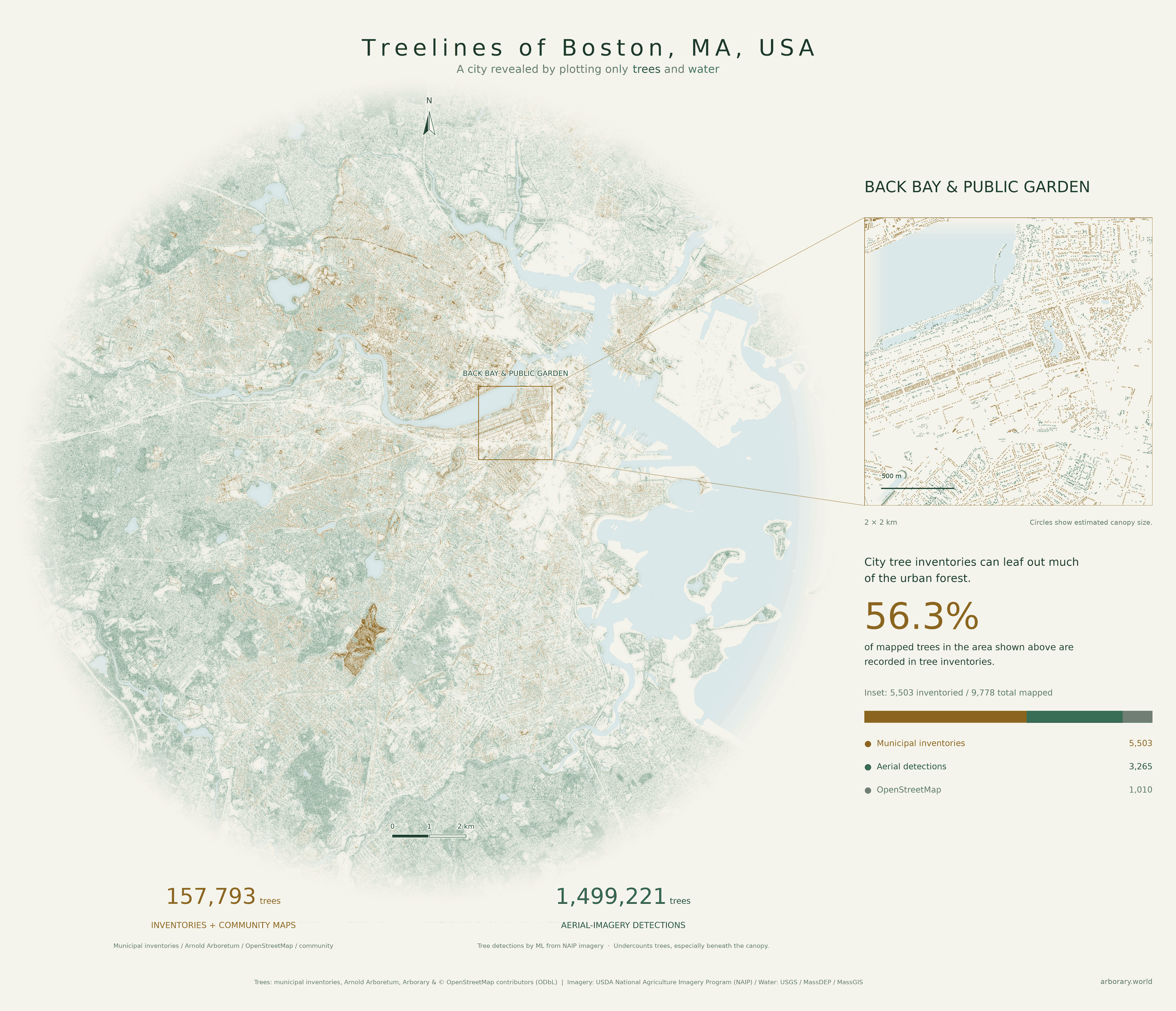
Back Bay & the Public Garden
A close-up follows the planted streets of Back Bay into the Public Garden, comparing inventory records with aerial detections.
Boston
A close-up follows the planted streets of Back Bay into the Public Garden, comparing inventory records with aerial detections.