Skip to content
Image gallery
San Francisco
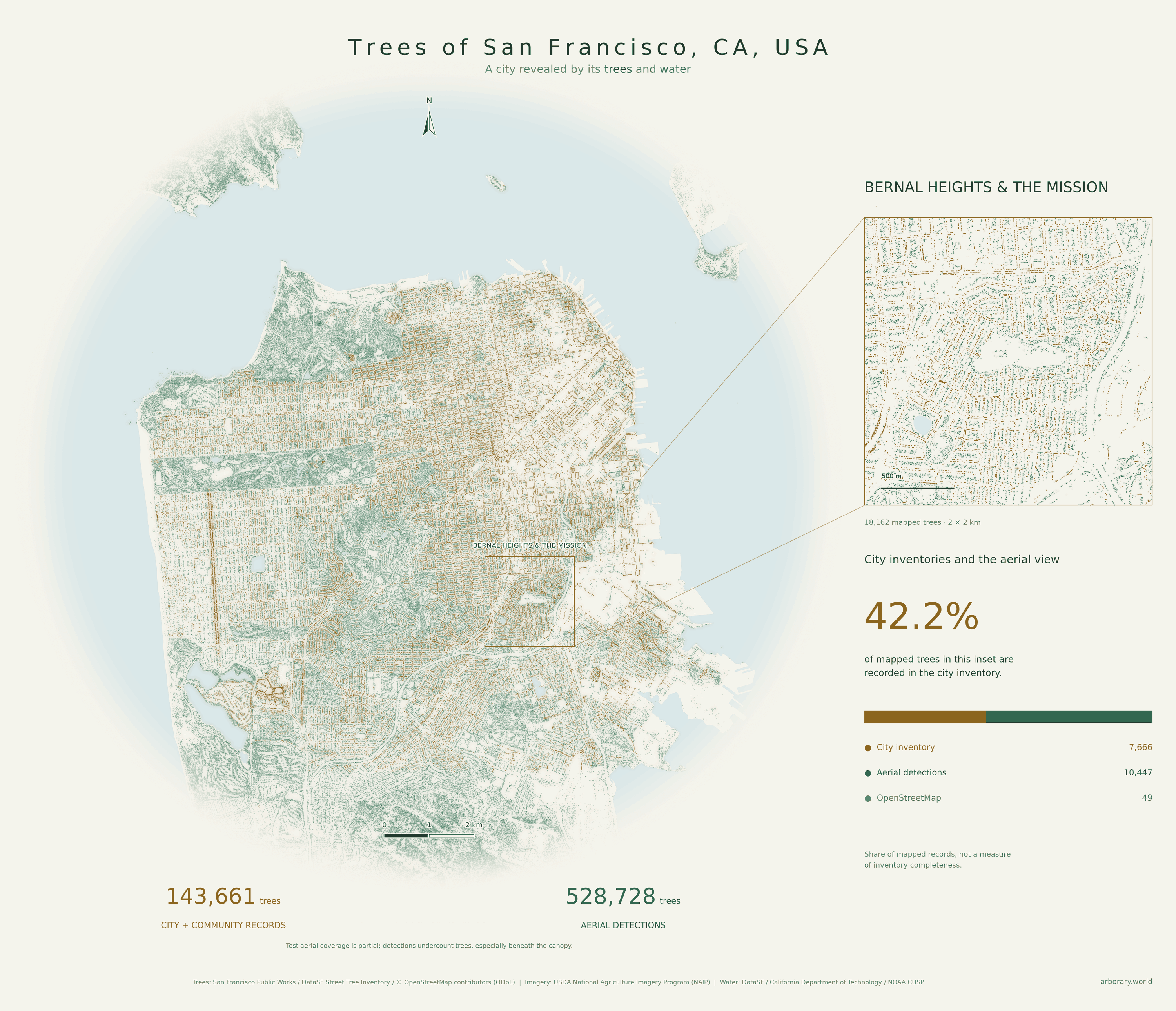
Bernal Heights & the Mission
A neighbourhood inset traces the change from the Mission street grid to the slopes of Bernal Heights.
San Francisco
A neighbourhood inset traces the change from the Mission street grid to the slopes of Bernal Heights.