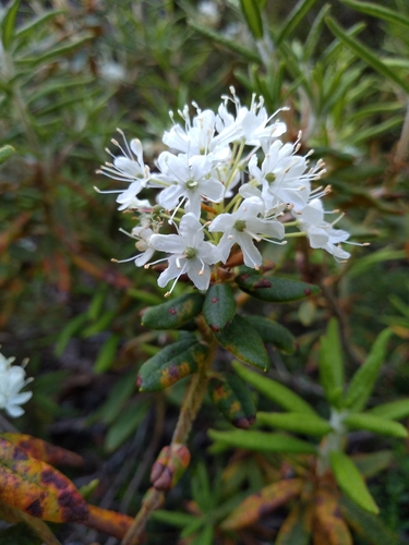
Rhododendron
Rhododendron · also Azalea, Tree rhododendron, Burans
Report an issue with this species
Rhododendron is a large genus of woody plants in the heath family, encompassing both evergreen and deciduous species. Known for their brightly colored flowers that bloom from late winter to early summer, some species can be small understory trees with distinctive foliage and peeling bark.
Where it grows
Trees in each city's inventory, with the share of that city's named trees this species accounts for.
- 8860.39%—3.8 in
- 4020.03%——
- 2290.20%9.6 yr7.5 in
- 380.00%—1.4 in
- 360.02%—12 in
- 100.00%——
- 80.01%13 yr2.0 in
- 60.01%—1.6 in
- 40.00%——
- 10.00%—5.9 in
- 10.00%——
- 10.00%——
Traits
- Mature height
- 5–20 ft
- Canopy spread
- 15–20 ft
- Growth rate
- Moderate
- Water needs
- Moderate
- Wildlife value
- Moderate
- Blooms
- Mar, Apr, May, Jun
Trunk diameters across every city: median 7.5 in, mean 7.0 in, 90th percentile 7.5 in. Measured at breast height, as published by each inventory.
Native range
Terrestrial ecoregions where this species is native. Trees in the dataset mostly stand well outside it.
Temperate Broadleaf & Mixed Forests
- Eastern Himalayan broadleaf forests
- Caucasus mixed forests
- Eastern Anatolian deciduous forests
- Western European broadleaf forests
Temperate Conifer Forests
- Eastern Himalayan subalpine conifer forests
Other Rhododendron in the catalogue
20 of the top 2,000 species are in this genus.


